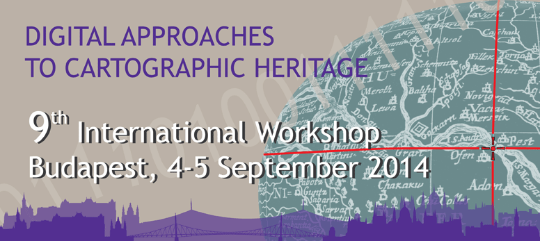
|
|
|
|
List of Papers Afferni R., T. Tambassi, Building a Geographical Ontology for Latin Literature Albert G., What Does an Archive Map Tell the Contemporary Map Readers? Information Transmissivity Analysis on the Survey Maps of the Josephinische Landesaufnahme (1763–1787) Antoš F., M. Talich, O. Böhm, Accuracy Testing of Cartometric Scanners for Old Maps Digitizing Arioti E., G. Bitelli, G. Gatta, Comparison of Two XVIII Century Technical Maps of Bologna, One Copied from the Other Ballarin M., C. Balletti, C. Gottardi, Automatic Systems for Digitizing Historical Maps Balletti C., C. Gottardi, F. Guerra, V. Tsioukas, P. Vernier, Old Map Stretching. Case Study of a 17th Century Old Map of Corfu Beconytė G., A. Balčiūnas, V. Nareiko, D. Romanovas, Cartographic Archives at Lithuanian Spatial Data Portal Biondani W., P. Chisté, Historical Cartography Digitization: The Experience of the Provincial Archive of Trento (Italy): Technologies, Methodologies, Metadata and Results Biszak E., H. Kulovich, S. Biszak, G. Timár, G. Molnár, B. Székely, A. Jankó, I. Kenyeres, Cartographic Heritage of the Habsburg Empire on the Web: the MAPIRE Initiative Boutoura C., The Course of Danube in Some Representative 18th Century Maps as Given Online in Textual and Image Structures by a Leading Web Provider of Digital Maps Cajthaml J., J. Havlíček, Some Important Aspects Influencing Results of Georeferencing Carhart G., The Fagel Map Project 2014-2015, Trinity College Dublin Dunn S., C. Roueché, T. Papacostas, N. Jakeman, V. Vitale, Whither Neutrality? Crowdsourcing Geographic Knowledge in Regions of Conflict Fodorean F. G., Mapping Archaeological Sites of Dacia Porolissensis Using Historical Maps. New Discoveries from Tureni and Aiton (Cluj County) Galambos C., Topographic Basis and Projection of Early Geological Maps about Hungary Gede M., Novel Globe Publishing Techniques Using WebGL Görlitz D., A. Bruschke, J. Bruschke, M. F. Buchroithner, Visualization of Early Globes (Approx. 1500 – 1550 A.D.) as a Source for Investigations Regarding the Early Cartographic Knowledge of South America and the Antarctica Hegedüs Á., G. Gercsák, Life and Works of Sándor Radó Hyndráková M., Virtual Exhibition of Globes Irás K., B. T. Nguyen, Geolocating System of Old Maps – Without Georeferencing Jeney J., The Use of Digital Technology in International Archival Map Research Kiss E., Zs. Ungvári, P. Fulajtár, Digital Map Collection Project at the National Széchényi Library Kiss T., The Map Collection of the Environmental and Hydrological Archives Kremers H., Location and Digital Cultural Heritage Multimedia Objects Granularity Kuśmidrowicz-Król A., Capturing and Sharing Information Hidden in Old Maps in a Digitised Era. The Problem of Cataloguing and Disseminating Information from Cartographic Collections – A Case Study Based on the Niewodniczanski Collection Imago Poloniae Livieratos E., New Perspectives for Expanding the Concept and Context of Cartographic Heritage in the Digital Domain Molnár G., G. Timár, E. Biszak, Can the First Military Survey Maps of the Habsburg Empire (1763-1790) be Georeferenced by an Accuracy of 200 Meters? Pazarli M., Righas’ Charta: A Thematic GIS Implementation Pődör A., Experiment of Involving Students in Preserving Geographical Names Appearing on Historical Maps Popovic M., Early Modern Cartography of the Balkans and its Contribution to the Knowledge of Local Transportation Infrastructures (1848-1918) Přidal P., GeoSEO and Map Series Discovery Integrated With Geographical Search in Map Catalogs Přidal P., International Image Interoperability Framework (IIIF) and Old Maps Roset R., V. Pascual, C. Montaner, From Gazetteer to Bounding Box: Using SDI Standards to Build a Geoportal for Ancient Maps in Catalonia Szabó R., Virtual Visualization of a Celestial Globe Timár G., J. Mészáros, G. Molnár, A Simple Solution for Georeferencing the Cassini Map Series of France Timár G., Zs. Bartos-Elekes, G. Molnár, Z. Imecs, Zs. Magyari-Sáska, Improvement of Horizontal Georeferencing Accuracy of the 1864 Map of South Romania by Correction Grid (GSB) in GIS and Web Publishing Environment Tóth L., Contribution of the Hungarian Military Mapping to the Cartographic Heritage Triplat Horvat M., M. Lapaine, Standard Parallels of Equidistant Conic Projections on Old Maps Tsioukas V., A. Koussoulakou, T. Jancsó, Falling into Place: Orientation and Viewing of Past Cityscapes in 3D Space Tsorlini A., L. Hurni, Digital analysis of Meyer - Weiss Atlas of Switzerland (1796-1802) and its Comparison With Dufourkarte (1845-1865) Ungvári Zs., A Method to Create Interactive Gazetteer to Old Globes Zentai L., Revisiting the Preservation of Modern Cartographic Products
|
|
|
|
|
|
Organised by |
|
|
ICA Commission Digital Technologies in Cartographic Heritage |
|
|
Supported by |
|
|
Commission supported by |
|
|
institut Cartogrŕfic i Geolňgic de Catalunya (Barcelona) Universitŕ IUAV di Venezia (Venice) National Library of Scotland (Edinburgh) Eötvös Loránd University (Budapest) Aristotle University of Thessaloniki (Thessaloniki) |
|


