
Map Exhibition
 In the frame of the Conference, a special Map Exhibition Corfu: 18th Century Planimetries of Baronies is organised by the Historical Archives of Corfu exposing unique manuscript Cadastre plans and land registers of the Island's Baronies, from the late Venetian domination of Corfu (18th century). The Exhibition is organised in cooperation with the ICA Commission on Digital Technologies in Cartographic Heritage and the AUTH Cartoheritage Group | Exhibition page and Catalogue here
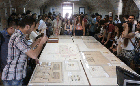
[ A group of 85 students from the Aristotle University of Thessaloniki, School of Rural and Surveying Engineering, accompanied by profs C. Boutoura and A. Kousoulakou, visited on 29 May the Exhibition and special collections of topographic maps and urban cadastres from the period of the Venetian domination of Corfu and the town plans from the period of the British rule. The head of the Historical Archives of Corfu Ms Nella Pantazi guided the students in their study visit | photo gallery ]

 |
|---|
Example of a manuscript Venetian General Cadastre documentation, Corfu, 1785 - Courtesy: Historical Archives of Corfu |

Example of a manuscript Venetian urban cadastre with multifold drawings of buildings stores

