|

|
|
|
Two
Map Exhibitions
In
the frame of the Workshop the map exhibition Holy Mount Athos Metamorphoses on maps was
organized at the Museum of Byzantine Culture with maps of the Holy
Mount Athos from the first half of 16th c. to early 19th c. in
cooperation with the Mt Athos Map Library and the National Centre for
Maps and Cartographic Heritage.
|
|
The
publication accompanying the Mt Athos map exhibition
|
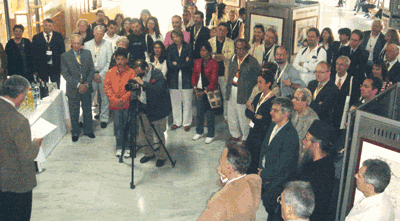
The
inauguration of the Mt Athos map exhibition |
Twenty maps, covering four centuries of map history are
representing Mt
Athos in various forms, by Benedetto Bordone, Pierre Bellon du Mans,
Marco Boschini, Alain Manesson Mallet, Francesco Piacenza, Vicenzo
Maria Coronelli, Johann Bernhard Fisher von Erlach, Choiseul-Gouffier,
Vladimir Davidov, Petr Sevastjanov, Georgios Katelouzos and Gerassimos
Smyrnakis.
A special publication is available (in
English); Order.

|
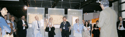
The
participants were also invited to visit the map exhibition City maps of Thessaloniki from late 19th to
early 20th century at the Municipality of Thessaloniki,
Directorate for Architectural Works. Almost 200 map-sheets of the first
large scale (1:500) city mapping in 1898-99 and 1909-10 as well as from
1919 were for the
first time exposed to the public in cooperation with the National
Centre for Maps and Cartographic Heritage.
A special publication of these city mappings is available (in
Greek); Order.
From left: L.
Michaelidou, J.A. Gaspar, L. Zentai, J. Reyes-Nunez, F. Ormeling, K.
Kowal, A. Pearson, L. Lovison-Colob, A-M. Peitila, J. Benavides, B.
Rystedt, M. Miletic-Drder, E. Livieratos (back), C. van den Heuvel.
Back
|
|
|